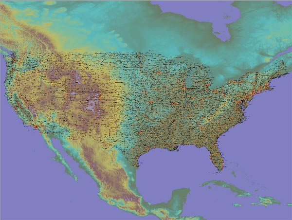
CONUS 48 STATES
Largescale Georef map
Globalmapper ready


Map Detail at 1:1 view of jpg

Large scale maps of CONUS generated in Globalmapper using Nationwide shape filesand DEMs.
Shape files used include:
-States
-Counties
-Roads
-Railroads
-Principal Aquifers

Images are 10240x7680, 8000x6000 and 4000x3000 pixels in width

Not recommended for use in 3d-mapper or Google Earth. The surface area covered by these maps is not appropriate for scaling
applications as with these two mapping systems. 3d Mapper provides a better mapping at 1:1 scale when compared to Google Earth, however neither maps display adequately. Scroll down for examples of image reslution comparion for these large tiles in both programs.

Global mapper georeferenced maps are available in the folders below.

doc/map: birch